Keswick 8 Peaks: the Mountain Festival hike
Eight Lakeland fells around Derwentwater and Borrowdale in one day — Catbells to Walla Crag, 17.7 miles and over 1,500m of climbing. What the Keswick Mountain Festival 8 Peaks hike is actually like, with my GPX from the day.
Download GPX Route
Import to Garmin, Komoot, or any navigation app
Getting there
Start: Festival Village, Crow Park, Keswick, CA12 5DJ
End: Festival Village, Crow Park, Keswick (circular)
Parking: Event parking at Keswick Rugby Club (~£15, book ahead); or walk in if you're staying in town
Before you go
Prices and times — worth a quick check before you travel
Keswick Mountain Festival — hike entry
The 2, 3 and 8 Peaks hikes are paid challenge events you enter in advance through the festival — not free public walks on the day. Entry includes festival access after 5pm. The 8 Peaks is the longest of the three. Dates and prices change each year; the 2026 festival is mid-May.
Festival site & entries · checked June 2026
Parking — Keswick (festival weekend)
Official event parking is at Keswick Rugby Club (~£15/car, book ahead as it sells out). Otherwise the town pay-and-display car parks fill early on festival weekend. If you are staying locally, walk in to the Festival Village at Crow Park (CA12 5DJ).
Travel & parking info · checked June 2026
Bus — Borrowdale (Keswick · Rosthwaite · Seatoller)
The Stagecoach 78 Borrowdale runs up the valley from Keswick past Rosthwaite — the bail-out option if you pull out at the Castle Crag cut-off rather than walking the Cumbria Way back. Roughly half-hourly in season, less in winter; fares change, so check before you rely on it.
Timetable & fares · checked June 2026
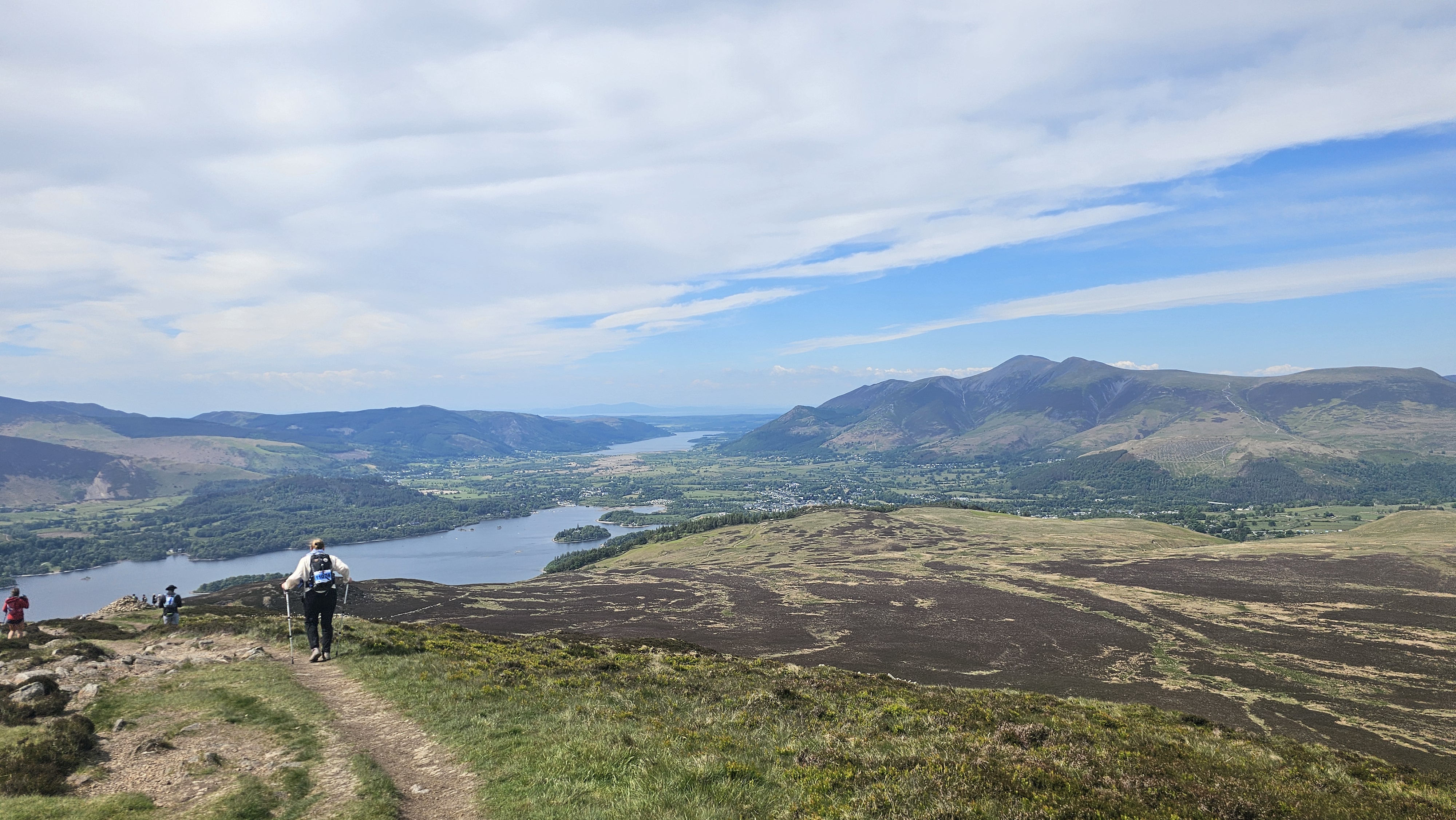
The Keswick Mountain Festival runs a series of hikes as part of the programme — a 2 Peaks, a 3 Peaks, and then the peak of peaks, the 8 Peaks. That’s the one we did. Heading anticlockwise around Derwentwater from Crow Park, you take in eight Lakeland fells in one leg-punishing, energy-sapping, rewarding day, before looping back to where you started for the food, drink and entertainment in the festival village. We did it on Sunday 18 May 2025, about as glorious a blue-sky day as you could hope to find.
We’ve been to the Keswick Mountain Festival several times over the years and we love it. We go with my partner, we go with friends, we meet people. There’s something good about being among like-minded folk in scenery as gorgeous as Keswick’s, and the whole market town takes on an outdoors feel with everything going on. We’ve done the 5k trail run and the 3 Peaks hike in previous years, and we’ve happily spent time just soaking up the entertainment, working through the food options — plentiful — having a coffee in the festival village and a nose round the exhibitor stalls. Unlike some festivals, Crow Park is right next to the town, so it’s easy to wander into Keswick itself and the pubs and eateries there. That’s a pleasant change from other festivals.
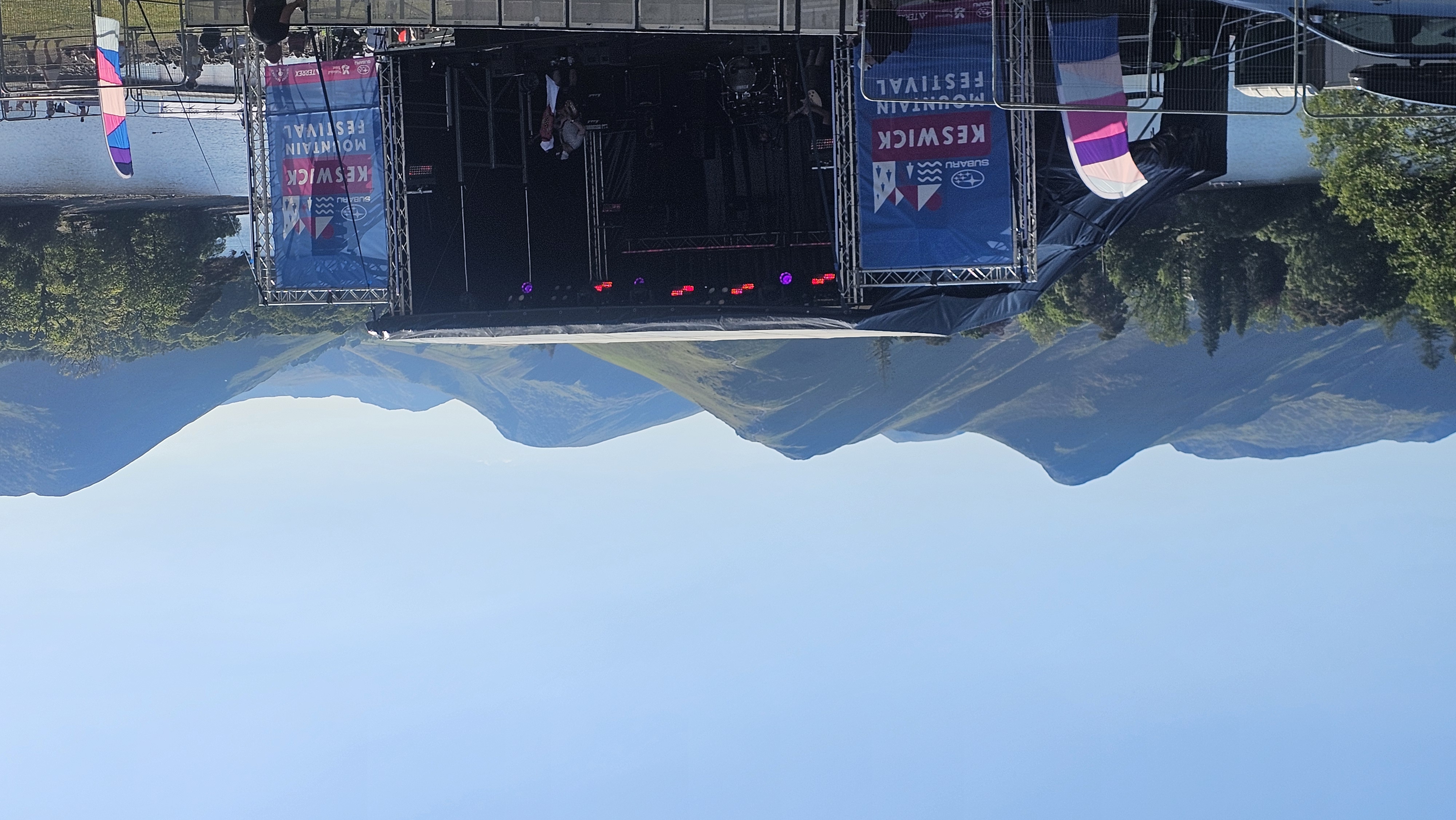
Out of Crow Park
The walk heads out of Crow Park, past the rugby club and down towards the Booths supermarket, then along the side of the river. You cross over on the path towards Grange and follow the west side of the lake — past Nichol End Marina and through the Lingholm estate — before the ground tips up and you start the climb of Catbells, the first of the eight. From there it’s on over Maiden Moor and High Spy down the west side, a drop to Castle Crag in the valley, then back up the eastern fells over High Tove, High Seat, Bleaberry Fell and Walla Crag to finish.
That’s 28.5km and a touch over 1,550m of climbing. My watch said closer to 2,000m. I’m not sure whether that’s the watch being optimistic or whether I genuinely climbed that far — there was a fair bit of nipping up and down along the way, not least supporting my partner.
The Catbells side
I know this first part very well — I’ve done it numerous times, and it’s still as glorious as the first time. On a day like this the views were incredible, and it was easy to pick out where we’d be headed for the rest of the walk. I felt fresh going up that first ascent, but I was mindful not to overdo it: there were a lot more miles and a lot more hours still to come. Maiden Moor and High Spy keep climbing after Catbells, and High Spy, at 653m, is the high point of the whole round.
Down to Castle Crag and the cut-off
The descent off High Spy down to Castle Crag is a bit of a knee-destroyer. It’s loose and rough underfoot, and a few people we saw were clearly finding it too much. Not everyone struggles with it, but I always walk with poles to take some of the force off my knees, and a descent like this is exactly why. Castle Crag itself is only 290m — it’s getting down to it that’s the work.
There are marshals at several points along the route for guidance and assistance. We met one at Castle Crag — I can’t quite recall the details, but I assume they radioed our number in to mark us off at the checkpoint. There’s a cut-off here too: you need to be through by quarter past twelve or you get signed out. We came down with a bit in hand.
Rosthwaite and the food stop
After Castle Crag the walking eases off for a while, and it took a little time to reach Rosthwaite, our designated food stop. They had tables set out in the street — an electrolyte drink and a bite to eat — and a chance for a toilet stop to set yourself up for the second half.
The back half
I don’t know this half anywhere near as well as the first, though I’d been up here before. From Borrowdale you climb back onto open moorland for High Tove and High Seat. It’s not as scenery-worthy as the front half, but it’s still pretty in its own right — a mix of paving slabs and boggy moss underfoot. By now a fair bit of time had passed and the weather had turned a touch, so it wasn’t quite as glorious as the morning. Honestly, it felt a bit more like a route march.
Then Bleaberry Fell, and finally Walla Crag, where the lake opens up below you again and the town comes back into view. Descending Walla Crag brings you down behind Springs Farm, past the Keswick Mountain Festival campsite, then through the woods and back into the festival site to finish.
If you fancy it
It’s a long, hard day on the hill rather than a stroll — eight tops, an early start and a cut-off to beat. But it links up a set of fells you’d normally pick off one at a time, with a festival waiting at the end of it.
If the full eight sounds like a lot, the 2 Peaks (12 miles) and the 3 Peaks run over the same weekend, same finish line. There’s more on all three on the Keswick Mountain Festival guide.
Practical notes
Entry, parking and the Borrowdale bus are in the Before you go box near the top.
It’s an event, not a route. The 8 Peaks is a paid festival challenge you enter in advance — the arrows, the food stop and the marshals are only there on the day. You can walk the same eight fells any time off your own back with the GPX above; just don’t expect the support.
Kit: the festival’s list is sensible — boots or fell shoes, waterproofs, a warm layer, map (OL4), compass and whistle, 1.5 litres of water and some food. The moorland half is exposed.
Where we stayed: we parked the van at the Camping and Caravanning Club site at Braithwaite, a couple of miles out — handy for an early start, with a pub and café nearby and a walkable route into Keswick.
The GPX above is our actual track from the day.
Walked 18 May 2025. Festival dates, entry and parking change each year — check keswickmountainfestival.co.uk for the current event.